![](/images/other/stat-length.png)
![Excursión Senderismo Les Salces - Tour des Monts d'Aubrac 4 - Photo](https://media.geolcdn.com/t/1900/400/ext.pjpeg?maxdim=2&url=https%3A%2F%2Fstatic1.geolcdn.com%2Fsiteimages%2Fupload%2Ffiles%2F1553511878bg_sport_marche.png)
Tour des Monts d'Aubrac 4
randotines
Usuario GUIDE
![Longitud](/images/other/stat-length.png)
Longitud
22 km
![Altitud máxima](https://static1.geolcdn.com/siteimages/upload/files/1508320355ic_sort_altitude_max_24dp.png)
Altitud máxima
1422 m
![Desnivel positivo](https://static1.geolcdn.com/siteimages/upload/files/1508320355ic_sort_den_pos_24dp.png)
Desnivel positivo
405 m
![Km-Effort](/images/other/stat-length.png)
Km-Effort
28 km
![Altitud mínima](https://static1.geolcdn.com/siteimages/upload/files/1508320355ic_sort_altitude_min_24dp.png)
Altitud mínima
1180 m
![Desnivel negativo](https://static1.geolcdn.com/siteimages/upload/files/1508320355ic_sort_den_neg_24dp.png)
Desnivel negativo
551 m
![Boucle](https://static1.geolcdn.com/siteimages/upload/files/16400158638029165_repeat_loop_refresh_sync_direction_icon.png)
Boucle
No
Fecha de creación :
2014-12-10 00:00:00.0
Última modificación :
2014-12-10 00:00:00.0
![Senderismo](https://static1.geolcdn.com/sitytour/trail-icons/101.png)
5h52
Dificultad : Medio
![Escanee este código QR para abrir la excursión en la aplicación SityTrail](https://capi.geolives.com/qq0zvz2zws4bq2lad0pu/sitytour/trails/178904/qr.png?size=200)
Aplicación GPS de excursión GRATIS
A propósito
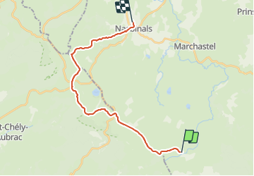
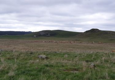
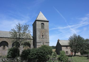
Ruta Senderismo de 22 km a descubrir en Occitania, Lozère, Les Salces. Esta ruta ha sido propuesta por randotines.
Descripción
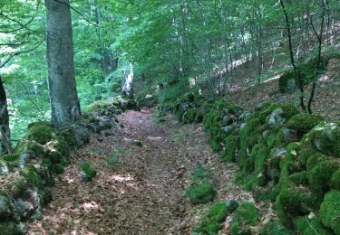
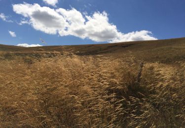
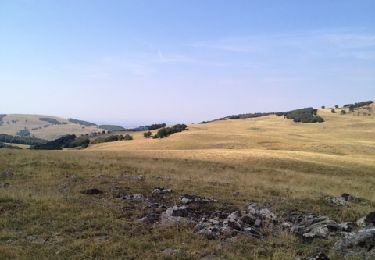
4ème étape : Buron de Rajas - Nasbinals, bien suivre la trace GPS dans la prairie puis arrêt pour visiter le buron de Cammejane en activité, étape la plus longue mais sans difficultés.
Localización
País:
France
Región :
Occitania
Departamento/provincia :
Lozère
Municipio :
Les Salces
Localidad:
Unknown
Salida:(Dec)
Salida:(UTM)
507427 ; 4935885 (31T) N.
Comentarios
Excursiones cerca
![Excursión Senderismo Saint Geniez d'Olt et d'Aubrac - Les Vergnes Mailhebiau Tourbière - Photo](https://media.geolcdn.com/t/375/260/e78d9056-9093-4928-88b6-4bbf4637125b.jpg&format=jpg&maxdim=2)
![Senderismo Senderismo](https://static1.geolcdn.com/sitytour/trail-icons/101.png)
Les Vergnes Mailhebiau Tourbière
Senderismo
Fácil
Saint Geniez d'Olt et d'Aubrac,
Occitania,
Aveyron,
France
![](/images/other/stat-length.png)
18,4 km | 24 km-effort
4h 52min
![](https://static1.geolcdn.com/siteimages/upload/files/16400158638029165_repeat_loop_refresh_sync_direction_icon.png)
Sí
![Excursión Senderismo Saint Geniez d'Olt et d'Aubrac - Croix de Rodes Lac de Bonnecombe Signal de Mailhebiau - Photo](https://media.geolcdn.com/t/375/260/656d423b-e3b9-47a3-b781-744261c38bdb.jpg&format=jpg&maxdim=2)
![Senderismo Senderismo](https://static1.geolcdn.com/sitytour/trail-icons/101.png)
Croix de Rodes Lac de Bonnecombe Signal de Mailhebiau
Senderismo
Fácil
Saint Geniez d'Olt et d'Aubrac,
Occitania,
Aveyron,
France
![](/images/other/stat-length.png)
19,9 km | 26 km-effort
5h 55min
![](https://static1.geolcdn.com/siteimages/upload/files/16400158638029165_repeat_loop_refresh_sync_direction_icon.png)
Sí
![Excursión Senderismo Les Hermaux - Rando Lozère.. Rajas..Malailhebiai. - Photo](https://media.geolcdn.com/t/375/260/d7d4238f-1d05-4619-84e8-be25d5ba8938.jpg&format=jpg&maxdim=2)
![Senderismo Senderismo](https://static1.geolcdn.com/sitytour/trail-icons/101.png)
Rando Lozère.. Rajas..Malailhebiai.
Senderismo
Muy difícil
Les Hermaux,
Occitania,
Lozère,
France
![](/images/other/stat-length.png)
20 km | 26 km-effort
4h 4min
![](https://static1.geolcdn.com/siteimages/upload/files/16400158638029165_repeat_loop_refresh_sync_direction_icon.png)
Sí
![Excursión Senderismo Nasbinals - Montorzier Croix de Vaysse Croix de Rodes - Photo](https://media.geolcdn.com/t/375/260/a81222cc-0444-4bf5-96c1-4ce2500b22df.jpg&format=jpg&maxdim=2)
![Senderismo Senderismo](https://static1.geolcdn.com/sitytour/trail-icons/101.png)
Montorzier Croix de Vaysse Croix de Rodes
Senderismo
Fácil
Nasbinals,
Occitania,
Lozère,
France
![](/images/other/stat-length.png)
15,4 km | 19,6 km-effort
4h 13min
![](https://static1.geolcdn.com/siteimages/upload/files/16400158638029165_repeat_loop_refresh_sync_direction_icon.png)
Sí
![Excursión Senderismo Les Salces - rajas st chely - Photo](https://media.geolcdn.com/t/375/260/9aaad3f4-6f6b-4807-af95-223f8ba68638.jpg&format=jpg&maxdim=2)
![Senderismo Senderismo](https://static1.geolcdn.com/sitytour/trail-icons/101.png)
rajas st chely
Senderismo
Medio
Les Salces,
Occitania,
Lozère,
France
![](/images/other/stat-length.png)
19,4 km | 24 km-effort
7h 27min
![](https://static1.geolcdn.com/siteimages/upload/files/16400158638029165_repeat_loop_refresh_sync_direction_icon.png)
No
![Excursión Senderismo Les Salces - Autour de maillebiau bonnecombes rajas - Photo](https://media.geolcdn.com/t/375/260/a70b3c7e-488a-42fa-a6af-35098b00d7a3.jpg&format=jpg&maxdim=2)
![Senderismo Senderismo](https://static1.geolcdn.com/sitytour/trail-icons/101.png)
Autour de maillebiau bonnecombes rajas
Senderismo
Medio
Les Salces,
Occitania,
Lozère,
France
![](/images/other/stat-length.png)
17,1 km | 22 km-effort
4h 23min
![](https://static1.geolcdn.com/siteimages/upload/files/16400158638029165_repeat_loop_refresh_sync_direction_icon.png)
Sí
![Excursión Senderismo Marchastel - cap combattut - Photo](https://media.geolcdn.com/t/375/260/eb793311-0e49-4670-bd6d-8912eba6bc33.jpg&format=jpg&maxdim=2)
![Senderismo Senderismo](https://static1.geolcdn.com/sitytour/trail-icons/101.png)
cap combattut
Senderismo
Fácil
Marchastel,
Occitania,
Lozère,
France
![](/images/other/stat-length.png)
7,2 km | 8,7 km-effort
2h 50min
![](https://static1.geolcdn.com/siteimages/upload/files/16400158638029165_repeat_loop_refresh_sync_direction_icon.png)
No
![Excursión Senderismo Les Salces - Tour des Monts d'Aubrac - Du refuge des Rajas à Nasbinals - Photo](https://media.geolcdn.com/t/375/260/ext.jpg?maxdim=2&url=https%3A%2F%2Fservices.sitytrail.com%2FGeolivesWS%2FDownloadMedia.ashx%3FTrailID%3D172692%26Media%3D14070_6.jpg)
![Senderismo Senderismo](https://static1.geolcdn.com/sitytour/trail-icons/101.png)
Tour des Monts d'Aubrac - Du refuge des Rajas à Nasbinals
Senderismo
Medio
Les Salces,
Occitania,
Lozère,
France
![](/images/other/stat-length.png)
22 km | 28 km-effort
5h 30min
![](https://static1.geolcdn.com/siteimages/upload/files/16400158638029165_repeat_loop_refresh_sync_direction_icon.png)
No
![Excursión Senderismo Les Hermaux - Signal de Mailhebiau - Photo](https://media.geolcdn.com/t/375/260/ext.jpg?maxdim=2&url=https%3A%2F%2Fservices.sitytrail.com%2FGeolivesWS%2FDownloadMedia.ashx%3FTrailID%3D152984%26Media%3D20120909121339.jpg)
![Senderismo Senderismo](https://static1.geolcdn.com/sitytour/trail-icons/101.png)
Signal de Mailhebiau
Senderismo
Medio
Les Hermaux,
Occitania,
Lozère,
France
![](/images/other/stat-length.png)
21 km | 27 km-effort
4h 45min
![](https://static1.geolcdn.com/siteimages/upload/files/16400158638029165_repeat_loop_refresh_sync_direction_icon.png)
Sí